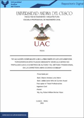
| dc.contributor.advisor | Merino Yépez, Robert Milton | |
| dc.contributor.author | Leiva Marin, Sharon Adriana | |
| dc.contributor.author | Niño de Guzmán Arpasi, Joddai Javier | |
| dc.date.accessioned | 2021-12-22T21:09:01Z | |
| dc.date.available | 2021-12-22T21:09:01Z | |
| dc.date.issued | 2021-09-24 | |
| dc.identifier.uri | https://hdl.handle.net/20.500.12557/4337 | |
| dc.description.abstract | En la actualidad dentro del Territorio Peruano los levantamientos topográficos son realizados
de manera tradicional utilizando solo un método que es el uso único de la Estación Total
descartando otros métodos como el uso de UAV Dron teniendo una idea equivocada que
arrojen resultados con precisiones muy bajas, así como generar costos muy altos; por eso es
necesario poner en funcionamiento el uso de técnicas y nuevos procesos tecnológicos para
reducir los temas de imprecisión, costo ,tiempo de ejecución y mejorar el desempeño en este
tipo de proyectos .
La presente investigación tiene como alcance una comparación de la precisión que se obtiene
en un levantamiento topográfico con equipo Aéreo no Tripulado UAV Dron y la Estación Total
el estudio fue realizado en la carretera Abra Ccorao - Ccorao iniciando en la Progresiva 15+000
y culminando en la progresiva 20+000 en el Centro Poblado de Ccorao, Distrito de San
Sebastián, Provincia y Departamento de Cusco.
El desarrollo de la tesis inicio con los vuelos fotogramétricos de la zona de estudio con el Dron
Modelo Mavic 2 Pro , posteriormente se procesó las fotografías con el software Pix4D Pro que
nos dio como resultado la obtención de la ortofoto y nube de puntos que se pudo digitalizar en
un plano topográfico con el programa AutoCAD Civil 3D que nos permitió conseguir los datos
para comparación de la precisión entre ambos equipos ,de forma simultánea se evaluó variables
que tiene como dimensión el costo y el tiempo de realización para llegar a las conclusiones
respectivas.
De acuerdo a los resultados obtenidos, en el capítulo IV indican que el uso de equipo aéreo no
tripulado UAV es más preciso para proyecto de carreteras demostrando que los valores de
errores absolutos y relativos son menores en comparación con un levantamiento realizado con
Estación Total, reduciendo el tiempo de realización.
En conclusión, con la presente tesis se busca mostrar que ambos métodos son eficientes puesto
que muestran resultados muy cercanos y que el uso del Dron en levantamientos topográficos es
más óptimo para trabajos de gran magnitud de área, lugares inaccesibles por su facilidad de
manipulación y tiempo de realización. | es_PE |
| dc.description.abstract | At present, within the Peruvian Territory, topographic surveys are carried out in a traditional
way using only one method that is the sole use of the Total Station, discarding other methods
such as the use of UAV Drones having a wrong idea that yield results with very low precision,
as well. how to generate very high costs; That is why it is necessary to put into operation the
use of techniques and new technological processes to reduce the issues of imprecision, cost,
execution time and improve performance in this type of projects.
The present research has as its scope a comparison of the precision obtained in a topographic
survey with Unmanned Aerial UAV Dron equipment and the Total Station.The study was
carried out on the Abra Ccorao - Ccorao highway, starting at the Progressive 15 + 000 and
culminating in the progressive 20 + 000 in the Centro Poblado de Ccorao, District of San
Sebastián, Province and Department of Cusco.
The development of the thesis began with the photogrammetric flights of the study area with
the Mavic 2 Pro Model Drone, later the photographs were processed with the Pix4D Pro
software that resulted in obtaining the orthophoto and cloud of points that could be digitize in
a topographic plane with the AutoCAD Civil 3D program that allowed us to obtain the data for
comparison of the precision between both teams, simultaneously variables that have as
dimension the cost and the time of realization were evaluated to reach the respective
conclusions.
According to the results obtained, in chapter IV they indicate that the use of UAV unmanned
aerial equipment is more accurate for highway projects, showing that the absolute and relative
error values are lower compared to a survey carried out with a Total Station, reducing the time
of completion.
In conclusion, this thesis seeks to show that both methods are efficient since they show very
close results and that the use of the drone in topographic surveys is more optimal for large-area
work, inaccessible places due to their ease of handling and time. of realization. | en_US |
| dc.format | application/pdf | es_PE |
| dc.language.iso | spa | es_PE |
| dc.publisher | Universidad Andina del Cusco | es_PE |
| dc.rights | info:eu-repo/semantics/openAccess | es_PE |
| dc.rights.uri | https://creativecommons.org/licenses/by-nc-nd/4.0/ | es_PE |
| dc.subject | Fotogrametría | es_PE |
| dc.subject | Precisión--Estación Total | es_PE |
| dc.subject | Levantamientos topográficos | es_PE |
| dc.title | Evaluación comparativa de la precisión en levantamientos topográficos efectuados mediante vehículo aéreo no tripulado (UAV) a 50 metros de altura y el método tradicional en la Carretera Abra Ccorao-Ccorao | es_PE |
| dc.type | info:eu-repo/semantics/bachelorThesis | es_PE |
| thesis.degree.name | Ingeniero Civil | es_PE |
| thesis.degree.grantor | Universidad Andina del Cusco. Facultad de Ingeniería y Arquitectura | es_PE |
| thesis.degree.discipline | Ingeniería Civil | es_PE |
| dc.publisher.country | PE | es_PE |
| dc.subject.ocde | https://purl.org/pe-repo/ocde/ford#2.01.01 | es_PE |
| renati.advisor.dni | 23836204 | |
| renati.advisor.orcid | https://orcid.org/0000-0002-1329-4218 | es_PE |
| renati.author.dni | 74086686 | |
| renati.author.dni | 73623827 | |
| renati.discipline | 732016 | es_PE |
| renati.juror | Delgado Salazar, William Ronal | |
| renati.juror | Ascue Escalante, Kildare Jussety | |
| renati.juror | Alvarez Espinoza, Jorge | |
| renati.juror | Deza Cavero, Julio Benjamin | |
| renati.level | https://purl.org/pe-repo/renati/level#tituloProfesional | es_PE |
| renati.type | https://purl.org/pe-repo/renati/type#tesis | es_PE |


